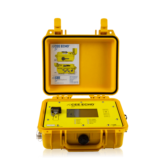
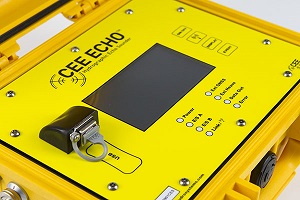
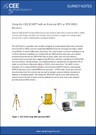
CEE ECHO™
A compact dual frequency hydrographic survey echo sounder – the perfect partner for your survey GPS.
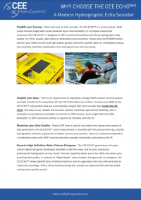
CEE ECHO™ is a state of the art portable echo sounder with advanced capabilities in a truly compact package. Internal data logging, full water column echogram and 20 Hz ping rate in a robust waterproof enclosure proves quality does not have to be sacrificed for convenience.
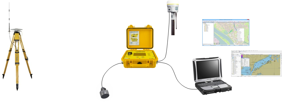
Able to interface with an external GNSS or GPS receiver, the CEE ECHO™ brings position and echo sounder data together to offer a greatly simplified and elegant survey solution. Using modern miniaturized electronic components throughout, sonar performance matches larger traditional echo sounder designs.
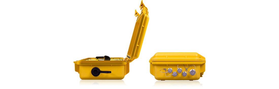
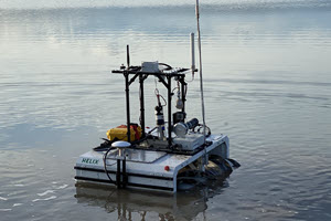
The CEE ECHO™ is a small, portable, rugged and waterproof single beam echo sounder for use on practically any survey boat from a kayak to a dedicated coastal hydrographic survey vessel.
LEARN MORE:
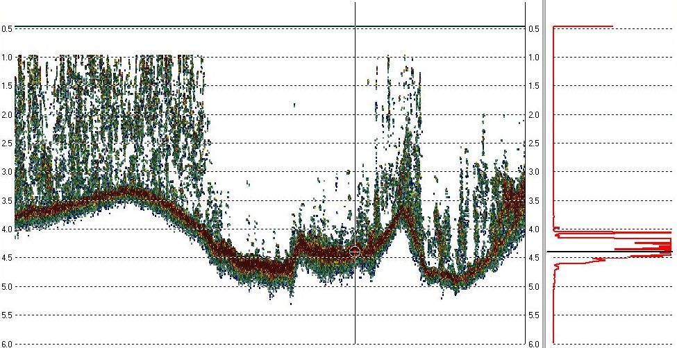
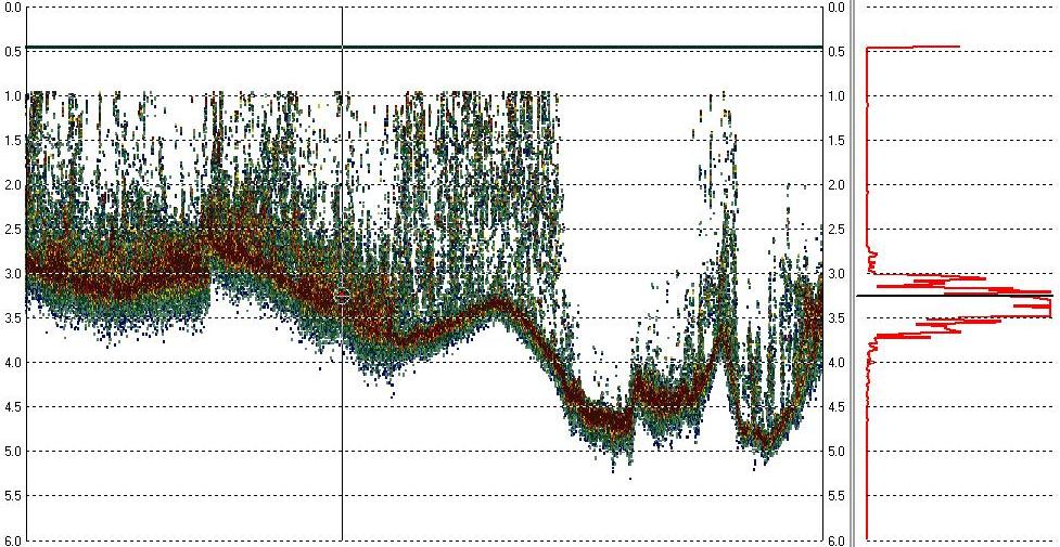
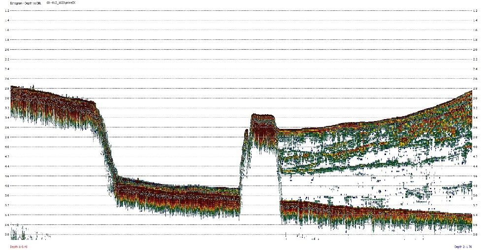
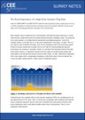
The CEE ECHO™ and CEESCOPE™ echo sounders can log soundings at up to 20 Hz, providing exceptional bottom detail along the survey track. In addition to the sounding depth output, the complete sonar echo return from each ping is digitized into 3200 separate and discrete values from just below the surface to the sub-bottom level. The intensity of the echo return from the entire water column and sub-bottom is recorded, not just the single sounding depth value for each ping. When it comes to reviewing data quality in real time and after the survey is completed, the echogram record presents a crucial advantage over basic echo sounders that output only the digital depth sounding value. For example, heavy bottom vegetation may be identified on the echogram and differentiated from the true bottom, a process that may be impossible with a basic echo sounder.
Top Images: Heavy sub-aquatic vegetation. Recorded in HYPACK® with a single frequency 200 kHz transducer.
Bottom Image: Sediment deposited behind a submerged wall. Recorded in HYPACK® with a dual frequency 33/200 kHz transducer.
Set the echo sounder to “Auto” or “Shallow” mode and the robust bottom tracking algorithms will manipulate the sonar pulse width and gain to keep a solid lock on the bottom with the minimum of operator involvement, even in very shallow water. The use of precise GNSS-derived time stamps for the complete dataset collected by the CEE ECHO™ ensures all soundings are accurately positioned. By routing all position data from the external GPS receiver to the CEE ECHO™, the system offers the flexibility to record a complete dataset with no connected PC and simplifies the data collection process when using hydrographic acquisition software.
Just turn on and start surveying! All of the functions of the CEE ECHO™ may be accessed through the LCD touch screen interface and CEE CONNECT control software utility, making the unit setup and configuration easy. For surveying when a laptop is not desired, such as on a small boat or personal watercraft, internal memory or an external USB flash drive can be used to record the entire survey including the full water column echogram.
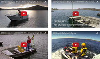
VIDEOS:
Watch HYPACK® data acquisition and simultaneous GoPro footage in an extremely shallow water environment. The CEESCOPE™ and CEE ECHO™ retain excellent bottom tracking in 33/200 kHz operation with a 19 / 8 degree transducer.
Watch this comparison showing what you see when using the CEE ECHO™ or CEESCOPE™ compared to a basic “black box” echo sounder. Avoid reporting inaccurate soundings with the exceptional detail and quality control of the CEE echo sounders.
Watch HYPACK® data acquisition and simultaneous GoPro footage in a lake with heavy sub aquatic vegetation. Unlike “black box” or “digital depth” echo sounders, the CEESCOPE™ and CEE ECHO™ provide a detailed view of what really lies beneath.
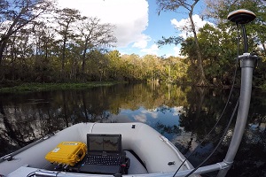
Connected to a Hemisphere AtlasLink GNSS with L-Band subscription corrections to handle the substantial tree canopy, the CEE ECHO™ surveys the Silver River near Ocala, Florida USA. With dense sub aquatic vegetation covering most of the area, post processing the detailed echo envelope results is the only way to map bathymetry.
FIELD APPLICATION NOTES:
PRODUCT INFORMATION
 |
 |
 |
 |
 |
 |
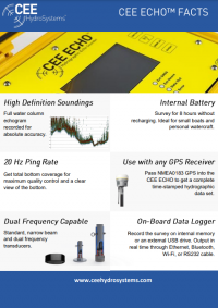
| 20Hz ping rate for high quality survey results | 3200 samples high definition echogram | Dual frequency capable | Precise GPS time-tagged data | Heave, pitch, roll and tide inputs | Manual control of echo sounder settings |
 |
 |
 |
 |
 |
 |
| LCD touch screen for exceptional ease of use | Internal battery with 8 hours of survey time | Internal data logger for standalone operation | USB file transfer and updates | Waterproof case for ultimate ruggedness | Modern powerful processor |
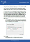
Interconnectivity between GNSS receivers and echo sounding equipment is a key area where CEE HydroSystems solutions are unique and unmatched. The CEE ECHO™ and CEESCOPE™ both feature a GNSS data viewer showing exactly which GNSS messages are received from the connected GNSS receiver. There is no need for a PC with a terminal program such as Hyperterminal or TeraTerm to check your GNSS receiver output, or otherwise waste time troubleshooting interconnects and GNSS receiver setup and output. With the on-board GNSS data viewer, the user knows exactly what the GNSS receiver is doing, leading to faster mobilization and fewer setup headaches.
|
|
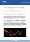
Learn how to connect an external GNSS receiver to the CEE ECHO™ and benefit from a streamlined user interface on the acquisition PC. For survey locations where a 200 kHz echo sounder may not adequately penetrate down to the bottom, the CEE ECHO™ 33/200 kHz or 24/200 kHz dual frequency upgrade adds a second channel offering greater penetration through water and loose sediment, sludge and silt. Commonly used on dredging-related surveys to distinguish the undisturbed bottom from the resuspended or redeposited material, the low frequency channel provides the added confidence that reported results are consistent with reality. With the dual channel full water column echo envelope displayed in real time and logged on hydrographic software, the dual frequency CEE ECHO™ can display a complex view of the bottom, with the 200 kHz data identifying the soft bottom and the 24 kHz or 33 kHz following the harder bottom surface underneath. |
For survey locations where a 200 kHz echo sounder may not adequately penetrate down to the bottom, the CEE ECHO™ 33/200 kHz or 24/200 kHz dual frequency upgrade adds a second channel offering greater penetration through water and loose sediment, sludge and silt. Commonly used on dredging-related surveys to distinguish the undisturbed bottom from the resuspended or redeposited material, the low frequency channel provides the added confidence that reported results are consistent with reality. With the dual channel full water column echo envelope displayed in real time and logged on hydrographic software, the dual frequency CEE ECHO™ can display a complex view of the bottom, with the 200 kHz data identifying the soft bottom and the 24 kHz or 33 kHz following the harder bottom surface underneath.
Learn how the dual frequency CEE ECHO™ can show detail about the bottom and sub-bottom layers with its high definition echogram output.
The CEE ECHO™ has several data input / output modes including Network (LAN), RS232 serial (cabled), and Bluetooth. The Bluetooth output may be useful for certain situations, for example when surveying on a kayak or when using a GNSS data collector to acquire bathymetry data. The Bluetooth radio may also be used to receive incoming GNSS position data from an external receiver. This option allows a redundant cable-free operation and may increase user convenience.
 |
Learn how to configure the CEE ECHO™ to output and receive data using its built-in Bluetooth radio. |
 |
Learn about the process used to collect hydrographic survey data with the CEE ECHO™ connected to an external GPS / GNSS receiver. Data are logged internally in standalone mode, or output to hydrographic software such as HYPACK® , QPS QINSy, Trimble HYDROPro, or Eye4Software Hydromagic |
 |
Learn how to connect a GNSS receiver to the CEE ECHO™ and use the data viewer for GNSS receiver troubleshooting. |
| Learn about the different transducer types’ beam angles and impacts when surveying on slopes or close to structures. | |
 |
Learn how to import data saved on the CEESCOPE™ or CEE ECHO™ internal memory or USB into HYPACK® or Hydromagic projects. |
| Learn about the new shallow water ADAPTIVE and MINDEPTH blanking modes for the CEESCOPE™ and CEE ECHO™, and an overview of the blanking distance background theory. Use this information to maximize your data quality and minimize your editing. | |
 |
Learn about the importance of a high echo sounder ping rate and why the CEE ECHO™ has a 20 Hz maximum sample rate. |
 |
Learn about the benefits of a full water column echo envelope (echogram) for single beam hydrographic surveying. |
 |
Learn about the general principles of hydrographic surveying using “RTK Tides”. |
 |
Visit the KNOWLEDGE BASE for more useful technical articles. |
|
|
|
 |
CEE ECHO™
| Physical | |
| Dimensions | 30.0 x 25.0 x 13.8 cm (L x W x D) 11.81" x 9.84" x 5.43" |
| Display | 420 x 272 touch screen colour LCD |
| Weight | 3.52 kg (7.7 lbs) |
| Colour | Yellow |
| Connectors | LEMO 1K & 2K Series, Industrial RJ45 |
| Environmental | |
| Operating temperature | 0°C – 50°C (32°F – 122°F) |
| Humidity | 95% non condensing |
| Ingress protection rating | IP67 |
| Power | |
| Power consumption | 6.8 watts |
| Internal battery | Rechargeable high capacity NiMH battery 10Ah |
| Power supply | Nominal 12.0 VDC @ 2A (9-24 VDC range) |
| Wireless Connectivity | |
| Bluetooth internal antenna | 0 - 50 m range |
| Data Logging | |
| Internal memory | 16 GB (32 GB optional) |
| External memory | 16 GB (32 GB optional) |
| Echosounder | |
| Mode | Auto shallow, auto or manual |
| Frequency | High band: 190 kHz – 210 kHz Low band: 30 kHz – 36 kHz (optional) |
| Output power | High: 200 kHz – 172 W RMS max Low: 33 kHz – 172 W RMS max (optional) |
| Resolution | 1 cm |
| Accuracy | 0.01 m +/- 0.1% of depth @ 200 kHz 0.10 m +/- 0.1% of depth @ 33 kHz (optional) |
| Depth range - 100 series | 0.15 – 200 m @ 200 kHz |
| Depth range - 200 series | 0.15 – 200 m @ 200 kHz 0.75 – 200 m @ 33 kHz (optional) |
| Sound velocity | 1350 – 1750 m/s Resolution 1 m/s |
| Transducer draft setting | 0 – 10 m (1 cm increments) |
| Index offset | 0 – 10 m |
| Blanking | 7 – 500 cm |
| Ping rate | 1-20 Hertz |
| Pulse length | 200 kHz 1-30 cycles 33 kHz 1-20 cycles (optional) |
| TVG | None, LOG 10, LOG 20 |
| Manual gain | 30 – 100% |
| Detection threshold | 10 – 50% |
| External Data Interfaces | |
| GNSS input | NMEA 0183 |
| Heave input | TSS 1 |
| Tide input | CEETIDE |
| Parameter | General Surveys | Engineering Surveys | Dual Frequency | Dual Frequency | Dual Frequency (USV) |
| Frequency: | 200kHz | 200kHz | 33 / 200 kHz | 24 / 200 kHz | 33 / 200 kHz |
| Beam Width @-3dB: | 9 deg | 3 deg | 19 deg / 8 deg | 20 deg / 5 deg | 26 deg / 9 deg |
| RMS Power | 500 W | 3 kW | 1 kW / 500W | 1.2 kW / 2kW | 500W / 500W |
| Q: | 2 | 6.5 | 7 / 2.3 | 8 / 2.1 | N/A |
| Cable Length | 9 m (30 ft) | 10 m (33 ft) | 11 m (36 ft) | 11 m (36ft) | 11 m (36ft) |
| Weight | 1.3 kg (3 lbs) | 5.5 kg (11.6 lbs) | 9 kg (19.8 lbs) | 11 kg (24lbs) | 3.6 kg (8lbs) |
| Housing Material | Stainless Steel | Stainless Steel | Cast Urethane | Cast Urethane | Cast Urethane |
| Acoustic Window | Urethane | Urethane | Urethane | Urethane | Urethane |
| Products | Transducer | Dimensions | Bracket |
| General Surveys | 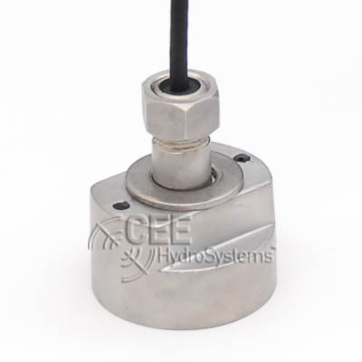 | 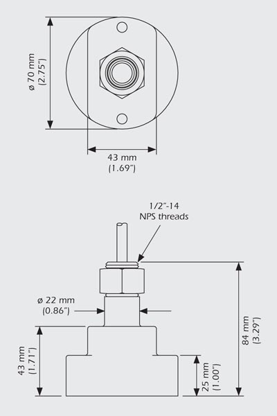 | 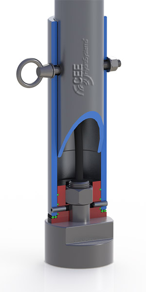 |
| Engineering Surveys |  | 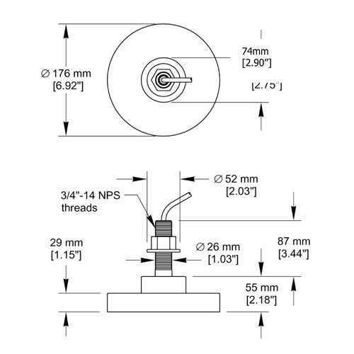 | 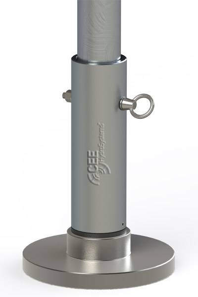 |
| Dual Frequency 33kHz | 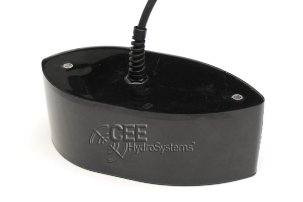 | 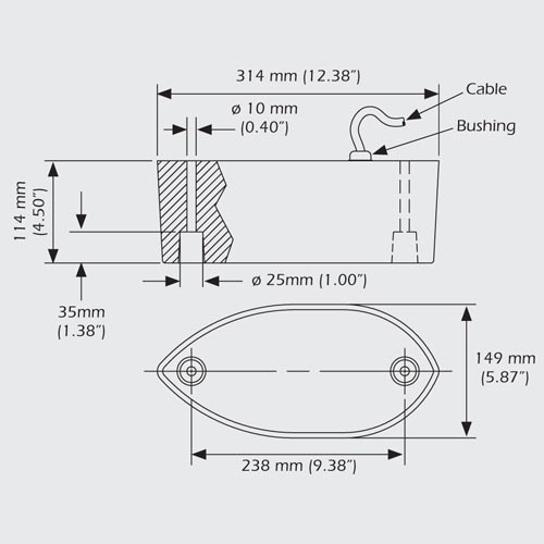 | 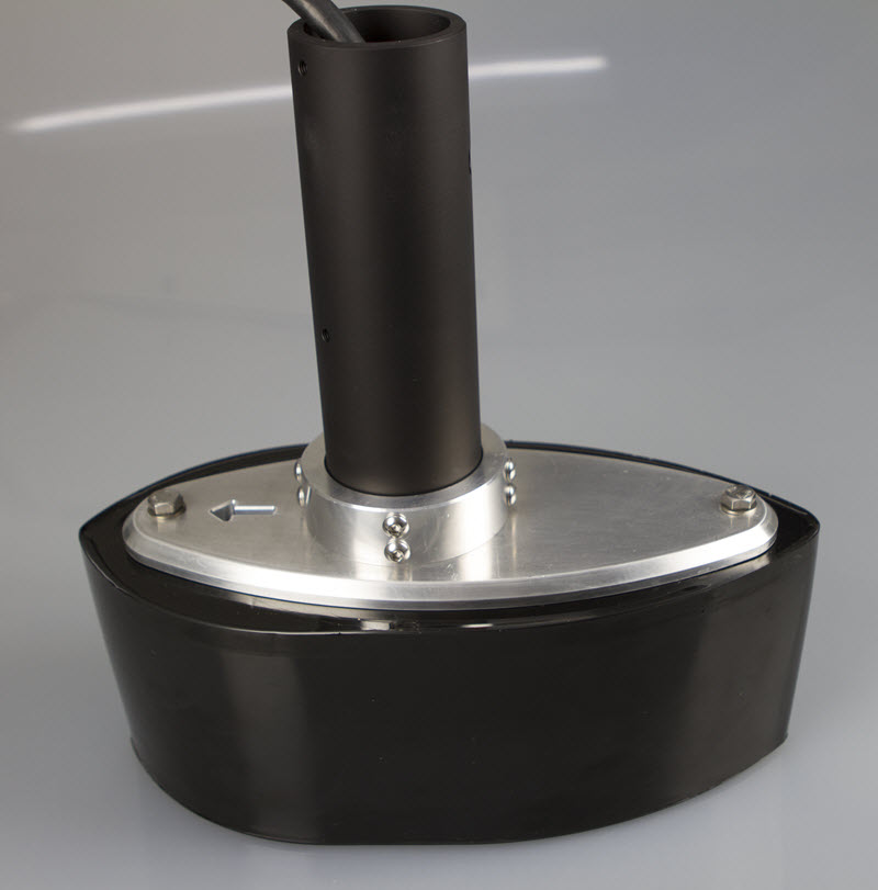 |
| Dual Frequency 24kHz | 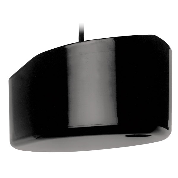 |  | |
| Dual Frequency USV | 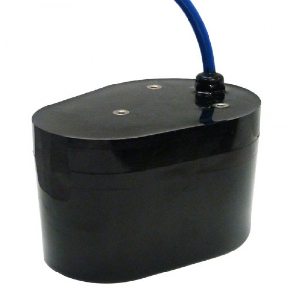 | 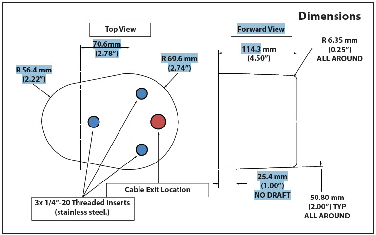 | 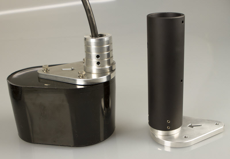 |
– Where do I connect my GPS?
We recommend GPS data are fed directly into the CEE ECHO™. This allows all data to be time stamped, saved, and output in a single highly accurate data stream with minimum latency.
– Can I use RTK GPS?
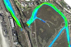
Yes. RTK can be used with the CEE ECHO™ to generate a bottom elevation point cloud in the hydrographic survey software, consistent with the local grid coordinates and vertical datum.
– How long does the battery last?
The rechargeable battery will last 8 hours in operation, although this can be extended by turning off the touch screen display when not required.
– How long does it take to recharge the battery?
The battery will recharge in 4 hours. The battery will NOT recharge unless the unit is powered off.
– Can an external power source be used?
Yes. Any 12-24V supply may be used.
– What is the maximum depth achievable?
100m is the limit for both 33 kHz and 200 kHz transducers. The CEE ECHO™ is designed to output soundings of high quality in shallow water.
– Can I use my own existing transducer, eg Odom?
Yes. We can supply patch cables for third party transducers with Amphenol connectors.
– How is the transducer mounted?
The transducers can each be supplied with a matching mount that will fit standard 50mm OD pipe. The transducer cable is passed up the inside of the pipe to prevent damage
– Can I use 24 kHz or 28 kHz transducers?
Yes. The CEE ECHO™ is designed for transducers at 24 kHz or 33 kHz.
– How waterproof is the unit?
A special custom manufactured lid seal is used to ensure water cannot penetrate through the box and the seal will remain intact after years of use. Waterproof rugged LEMO cable connectors are used.
– Do I need an acquisition computer?
No. While the CEE ECHO™ is often used with a laptop collecting the data in real time, it has internal memory allowing collection of all data with no connected PC. This also serves as a useful backup data log.
– Can I use a hand held data collector, such as Trimble TSC2 or TSC3?
Yes. The Bluetooth data output from the CEE ECHO™ may be accepted by land survey data collectors after pairing the devices. Depth measurements from the CEE ECHO™ may then be stored in a point data file with GPS data.
– How do I take data off the CEE ECHO™?
Inserting a USB flash drive into the USB port will cause data to be automatically copied onto the external USB.
– How do I change the units’ settings?
All the settings are available through the touch screen display with a simple on-screen menu system. A computer is not required to change any of the CEE ECHO™ settings, however the CEESCOPE CONNECT software utility allows settings to be changed through a connected PC.
– Can I change the echo sounder sonar settings?
Yes. The high and low frequency channels can be independently adjusted in terns of pulse width, gain, detection threshold, blanking distance, and maximum depth to follow the desired bottom surface.
– How do I conduct a bar check?
The CEE ECHO™ has a special bar check routine to make it easy to conduct a calibration check. A connected PC is not required to complete this procedure.
– Can I adjust sound velocity (SV)?
Yes. Enter the SV value directly into the CEE ECHO™, or input the temperature and salinity and the SV will be calculated.
– What are the output formats?
The CEE ECHO™ outputs a proprietary output format including GPS position, sounding depths, and a full water column echogram binary packet file in a time-stamped data stream. Other industry standard formats may be selected such as DESO25, Odom SBT / DBT, NMEA0183.
– What software package is required?
The CEE ECHO™ will work with all available hydrographic acquisition packages. The package used must contain a driver for the CEE HydroSystems digital echogram to be able to see the water column envelope. HYPACK® is the most suitable option.
– Where do I mount the transducer?
The transducer ideally should be mounted half way between bow and stern to minimize motion from waves, and should be braced with ropes fore and aft to prevent movement in the water. The minimum draft should be 50cm from the water surface to the transducer face, or slightly above the keel depth.
– What is the typical survey speed?
Usually 4-6kts. Surveying at over 8 kts may cause issues with air bubble entrainment.
– Can I mark points of interest / events?
Yes. The “event” button creates a sequential event number in the data record, associated with the exact position and depth when the button is pressed.
– Can I use the CEE ECHO™ with an ADCP?
Yes. The GPS and/or depth data may be routed to an acoustic Doppler current profiler such as the Teledyne RD Instruments River Ray, River Pro, and Rio Grande to collect simultaneous velocity measurements.